ProNebo -
To help the workers of the sky!
To help the workers of the sky!
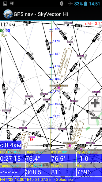
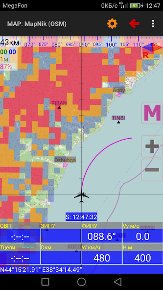
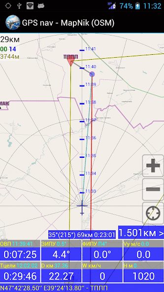
- Aviation GPS Navigation;
- GPS Landing.
- Calculations Using GPS Data.
- Calculation of the Flight Route (IHR) According to the weather forecast.
- Other Aviation Calculations;
- Time Calculator;
- View the TAF / METAR / NOTAM REPORTS OF INTERNATIONAL AIRPORTS AND DECODE Them;
- Viewing of Area Weather Forecasts.
- Loading and viewing of Weather Maps, Weather Section Along The Route, Meteor Radar and Satellite images;
Help file to the program: http://navair.narod.ru/download/pronebo_help.pdf.
Discussion at forumavia: http://www.forumavia.ru/a.php?a=t&id=13080.
Discussion at 4PDA: http://4pda.ru/forum/index.php?showtopic=382528.
Group VC: https://vk.com/club159833375
What's new in the Latest version 7.3
Last Updated on Mar 11, 2021 V.7.3 (10.03.21)Added:
- New formula of humidity in guesses;
- New formulates of spacific of harmless Vysot;
- Command of the flying on, can create a DOP route;
- Optimization of Aérodromov in BD, the first launch GPS can make some time;
- Russian notboard from Maps.aop.
Fixed:
- Fixed sharpened users;
- optimization and enthusiasm programs programs;
- interface routes on the preference for users.