Geovelo Rennes -
Bike routes, Sailing, Bike Star, and Community Contributions, GPS Bike
Geovelo is an application that offers the calculation and guidance of a bicycle route on Rennes.
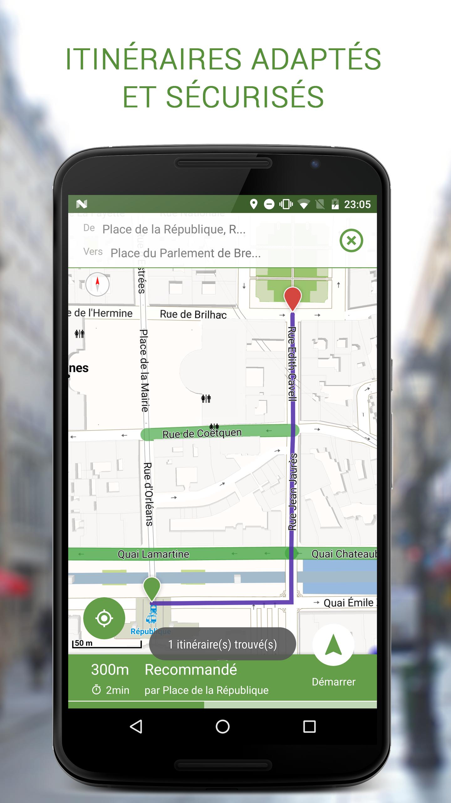
★ Calculation of personalized routes
The application adapts to your type of bicycle, to your average travel speed, to the desired type of course (from fastest to secure). GEOVELO chooses primarily the slopes, cycle bands and not very busy streets to ensure comfort, safety and tranquility.
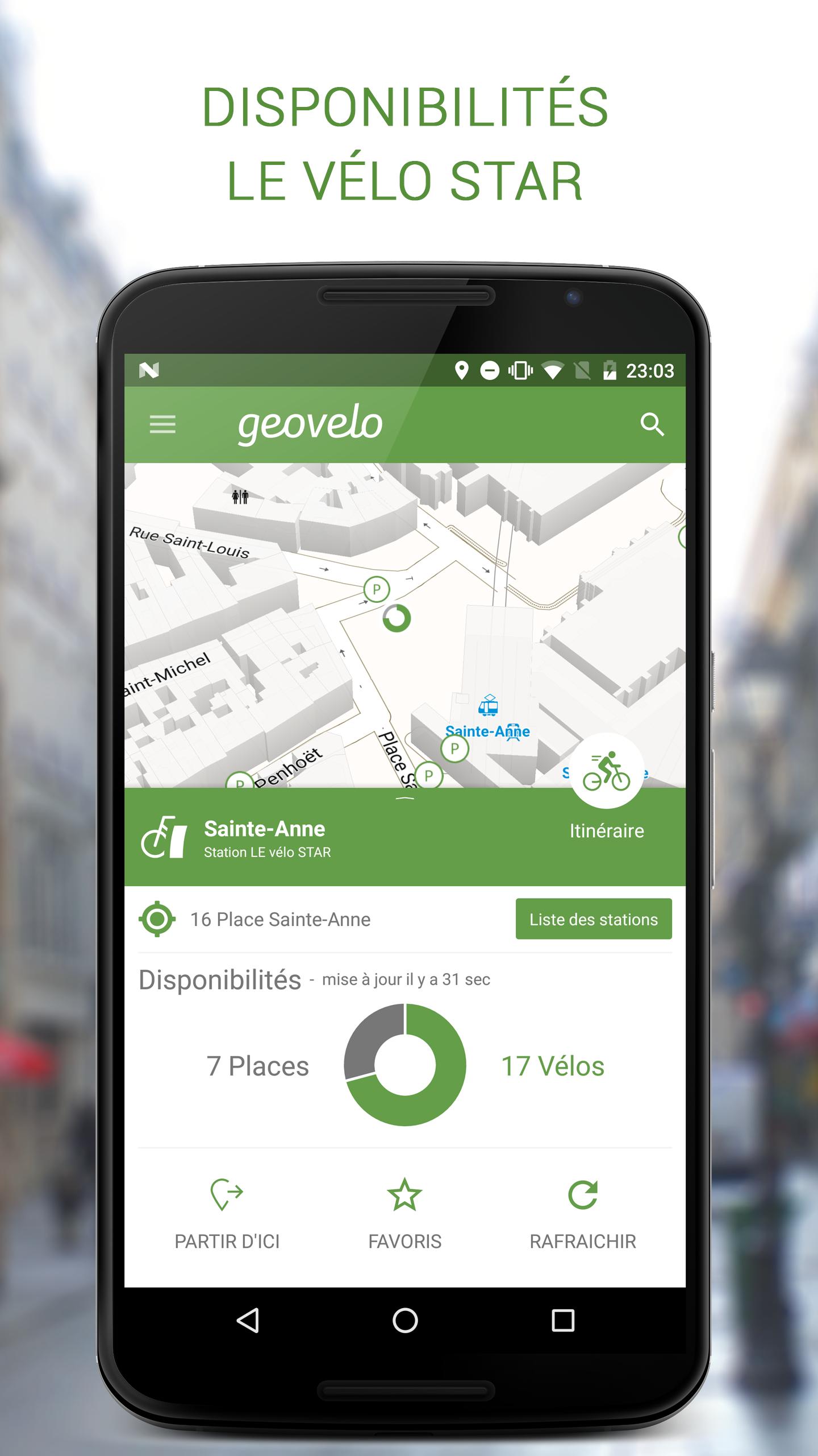
★ Star bike availability
Geovelo uses the data provided by Keolis to display the positions and availability of bikes and real -time parking spaces.
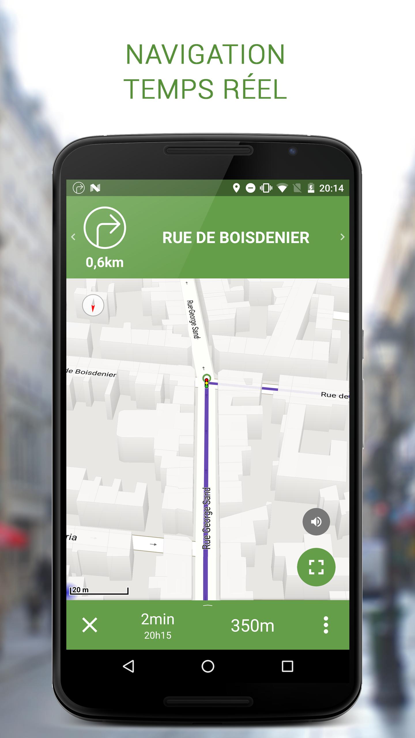
★ real time guidance - bike gps
Geovelo includes a real -time guidance system, with vocal indications, taking into account connected watches (Android Wear).
Please note: for the moment, this feature is only accessible to BETA users.
★ Tools
The application has many tools such as displaying cycle facilities, local weather, searching for simplified address, etc.
★ Beta-testers
Try new preview features by becoming testers on beta versions of the application.
Nothing could be simpler, just join the Geovelo community here: https://goo.gl/fpm1xb
★ Support us
If you like this application, to help us you could take the time to click on the +1 button and note 5 stars.
☆ Partners
This project was co -financed by the City of Rennes and the Rennes Métropole agglomeration.
☆ Data
Geovelo is based on OpenStreetMap data which is an international project aimed at creating a free card. Any type of data can be collected and in particular data concerning cycle arrangements for bikes. Geovelo is one of the main French contributors: we collect and correct data on French territory.
Let's stay connected:
* Love us on Facebook: http://facebook.com/geovelo
* Follow us on Twitter: @Geovelofr
* Visit our website: www.geovelo.fr
What's new in the latest version 7.0.6
Last updated on Oct 3, 2017 Cartographic Revolution3D card, new compass, simplified theme, accessible card without internet
On the right fire
Oblique navigation view, zoom adapted to the situation, bug correction
Memories, memories
Routes saving, history of recent routes
Dashboard
Direct route monitoring, automatic activity detection